Thursday, August 21, 2014

So yeah...we made it to California!

We made it to California.  We are currently in Arcata and we just wanted to put out a quick, explicit, and abridged post to let people know.  We'll fill in the time lapse with stories and more pictures mas tarde!

We have gone about 3200 miles...the Golden Gate is our finish line.  :D  Thanks for reading!

 The Pacific at the Oregon Coast!

Californy


Saturday, August 16, 2014

July 29 to August 4


It was a cool morning when we left Dayville.  We all left on our own terms from the old, white church on the hill and at our own pace so that there was at least a mile or two between each of us.  Steadily, we made our way through fossil fields and shaded ravines.  The landscape was desert-beautiful.  High painted hills in the distance surrounded by fenced-off cattle fields and sparse fruit trees growing next to nearly-dried stream beds.  The cool air gave the desert a temporarily benign quality which heightened the senses like being next to an anesthetized grizzly bear breathing at your feet.  It was quiet with little traffic.

Under one of the few large oak trees on the side of the road sat a couple from New York who we met at the Presbyterian church the night before.  Joel worked as an attorney in New York and when his firm took cuts he opted to go. His wife, Rose is Columbian.  They talked to their daughter (Emily) in their respective home languages.  It was fun to listen to their conversations while at the Presbyterian church.  Rose responded to every sound out of her daughter's mouth:

Ma.
Si?
Mama
Si mi amor?
...
Tu estas perdida?
Dime.

They had left before us and were taking it slow and steady up the pass.  I waved and smiled and said it was a great day to be biking.  Joel cried, "Water, Water!" and I laughed and kept going on the empty road.

The climb up the first pass was almost unnoticeable.  There was little traffic and we found ourselves alone much of the way.  Near the top of the first pass we came around a bend in the road and were able to see up the road.  Far up was a lone dead tree--it's bleached white branches sprawled upwards towards the sky.  But this tree was covered in some unnatural material.  From a mile off it looked as though there was garbage hanging all over it.  At one point I thought it was hundreds of pairs of shoes strung from the branches lolling dumbly back and forth in the light wind.  But that couldn't be it, we were miles from any town in the middle of the Oregon desert.  As I approached the tree the words "What the fuck?" fell out of my mouth.  It was a lone tree in the middle of nowhere covered in hundreds of pairs of shoes.  I stopped to take pictures and eat a granola bar just looking at the various kicks attached to it.  Roy pulled up, laughed hard, and went to attach his crappy Wal-Mart sandals I bought him back in North Dakota.  He kept going.  Brady made his way up and I heard him say exactly what I said when I rolled up to it.  Down the road another 12 miles we were braking and I asked Jess what she thought of the shoe tree.  She hadn't even noticed it--just rode right on past.  I asked her if she had seen the bear with a pair of pants on eating a moose on the side of the road, too.

 After the first pass we descended into a valley to a town called Mitchell.  The town had one paved street but it had a nice grocery store and a bar.  The steep hillsides on either side made it feel isolated.  We ate on the boardwalk outside the grocery store.  An old man plodded by us slow and deliberately. "Up hill both ways from here," he said smiling with his whole face.  We laughed and said we knew.  We sat there and talked with the next pass heavy on our conscience.  Soon, the family from New York caught up with us.  "Didn't think I would see you guys again!"  Said Joel.  We showed him the elevation of the next 30 miles on our fancy A.C.A maps.  Wow, he said.  He went to show it to Rose, his wife.  Soon, we heard what sounded like a gunshot.  Roy ripped off the Schrader valve of his back tire while pumping it up.  Bad luck.  In 40 minutes we were saying goodbye to the adventurous young family and heading for our second pass.

Ochoco turned out to be the son-of-a-bitch we expected it be.  I started getting dizzy after the first few miles and had to pull over to chug kool-aid and breathe.  A huge part of the eastern side of the mountain had burned in a forest fire a couple days previous.  A see-through and blackened forest stood smoldering on either side of the road.  The forest floor was made of light grey ash and smoke and burnt things filled your nose.  There were two or three spots that looked like the summit but then the road started to climb again.  Everybody had to dig deep to get over this one.  My mantra was: "I'll quit up there.  I'll quit up there."  We stopped at a rest stop just after the summit.  We weren't supposed to stay as the mountain was still on fire in places but we didn't care.  We laid on the cement happy to be done with Ochoco.  Not far off, flames breached the green canopy lapping at the wide blue sky.  It was time to go.  We hopped on our bikes and started down the other side.

It was prettier on the other side.  Green, un-burnt forests and farms lined the road.  We stopped to check out a small, rattlesnake that had been run over that morning.  It was cute.  We camped at an rv park on a reservoir that night.

The next day we made it to Bend.  We hung out at a bike shop that served beer and coffee and overlooked the river.  Very Bendy.  Then we took a tour of Deschutes Brewery, a popular craft brewery centered in Bend.  Oregon is home to almost 170 craft breweries and hundreds more microbrews.  People love their beer culture out here.

That night we met up with one of Jess's friends at the Deschutes brewery restaurant for some good burgers and more beer.  We slept at Tumalo campground just Northwest of Bend so we were primed to make it to Sisters and McKenzie Pass the next day.

It showered that morning so the desert had a crisp refined look to it as we made our way to Sisters.  Sisters is a budding touristy town with breweries and ranches that butt up to the cascade mountains.  It is named for the three volcanic mountains the people call the "three Sisters".  We hung out at a cafĂ© and had biscuits and gravy and drank kombucha before heading up McKenzie Pass. 

The climb over McKenzie Pass was a unique ride.  McKenzie on the East side gets 5 inches of rain a year while the West Side gets 100.  As we climbed the pass the sage gave way to orange trunked ponderosa pine, to fields of jagged, blackened lava rock at the summit. The descent on the other side of the cascades yielded the coniferous rainforest I formerly imagined covering the whole state of Oregon.  The road switchbacked down into the piney kingdom.  Hemlocks and cedar towered above.  The underbrush, mainly ferns, salal and huckleberry got thicker as we descended.  All kinds of moss, fungus and lichens hung from the trees.  Breathing was enjoyable again compared to the dry pine-needle-y air on the east side.  We camped in Paradise campground that night in a cozy spot amidst a stand of large hemlock.  The ground was mossy and springy to the step.  After we got camp situated, Ryan and I headed down to the stream that ran through the campground.  It was rushing and had a light cerulean hue to it similar to the blue ribbons that decorate the valleys of glacier park.  The river was the coldest yet.  The air around it was cold and it smelled cold.  People kept watermelons and six packs of beer in between the rocks close to shore.  It was as if someone opened a giant freezer door in the middle of this humid, mossy forest we found ourselves in.  The water was sobering.  We stayed in long enough to get ourselves clean with our beer soap and got out.

The next day we continued our descent of the cascades into the Umpqua valley toward Eugene, Oregon.  There, we would be staying with Paul Nicholson and Virginia Lo, a couple we met while passing through hot spring territory in Idaho.  The road to Eugene was almost all downhill and hugged those deathly-cold, blue rivers from the cascades.  Blackberry bushes lined the roads.  At first I was greedy and filled my Nalgene full of them but soon noticed I didn't need to as they lined the roads and still do.  They make for perfect snack breaks.  Ryan got another flat that day.  Usually, we let the guy in back have the pump just in case a flat happens but we didn't do that this time so Ryan drew up a sign and stuck it to his back and walked his bike down the road.  It read:

Got Space?
Have Flat
Can't Fix

Ryan got picked up by a couple church boys and made it to Eugene before we did.  Upon arriving in Eugene we swam in the Willamette River and got in contact with Paul.  He met us downtown atop his fixed-gear Raleigh road bike.  He told us to follow him and we did.  We would learn that Paul is almost 70 but he bikes like he is much younger.  We had to try to keep up with him as he lead us over bike paths, down alley-ways and foot trails while commenting on the politics and architecture of Eugene.  After a few miles and multiple turns we ended up in Paul's secluded yard underneath a great jazzy oak tree.  Their house is stacked like decks of cards one on top of another to fit the contour of the sloping land.  It's a great house. That night we had spaghetti with sauce made from Paul's garden and talked about Eugene and Paul and Virginias' kids.  After dinner we showered and retired to their library/office.  The next morning we had Virginia's granola and Paul made us omelets.

Paul and Virginia are retired academics, their respective fields being psycholinguistics and computer science, but they are also politically active, write, and, on a $5 dollar bet made in the 70's, have since owned and operated bicycle shops.  Our trip reminded Paul of their bike touring days in Taiwan when they spent less than $50 on a couple fixed gear bikes and minimal gear and made it around the mountainous island.

That day we checked out Eugene for a bit.  We visited Bicycle Way of Life (Paul's shop), road around the park, spent time reading in coffee shops and drinking at pubs around the Whiteaker neighborhood.  It was our first non-cycling day after two weeks and we had averaged 65 miles a day--all through the mountains.  We were tired.

The next day we had  breakfast at the house and took pictures with the hippie oak.  Paul saw us off by leading us out of Eugene to the road to Corvalis.  Meeting Paul and Virginia was the best part of Eugene.  We thoroughly enjoyed their wonderful home, food, showers, and their interesting conversation, stories, and opinions.  They gave us the boost we needed for our push to Portland.  Expect a postcard in a few weeks, Paul and Virginia!  We hope to see you again sometime.  We cannot thank you enough :)

P.S. We ran out of land on Monday--we're at the coast!  Right now we're in Newport, Oregon having traveled over 3,000 miles in about 2 months.  We will have a post about Portland and our introduction to the Pacific up soon.  Thanks for reading!

Three Billies

Oregon Desert
Shoe tree in Nowhere, Oregon
Ryan fixin' his sandles to the tree.
Burnt Ochoco
Lava


Two Sisters in the Distance
Roy atop the Lava Castle
Rainforest Camping
Paul and Ginnie with us under the Hippie Oak


Only two billies made it (so far)

Tuesday, July 29, 2014

Idaho Panhandle/Through Hell/Into Oregon


We wound up staying at Bruces' in Missoula for almost three days.  The last night we cooked a big meal of pasta and took it easy.  Monday morning we visited the headquarters for the Adventure Cycling Association.  The ACA is the organization that put together the routes we are following across the country.  It started in the 1970's and the headquarters is something of a Mecca for bicycle tourists.  We got our picture taken and hung up in the ACA office, as is custom, and headed out of Missoula with Idaho in our sights.

The Trans America route out of Montana follows a series of rivers and streams and is flanked by endless boreal forest through the Bitterroot Mountains.  Moose-xing warnings are painted on the road in multiple places.  We never expected to actually see a moose, especially where the xing signs were placed, but apparently Montana transportation was not kidding when they painted the warnings.  At the second moose-xing warning I noticed Brady and Ryan had stopped.  Ahead of them seemed to be one of those black cut-outs shaped like the profile of a bull moose.  After three to four seconds the profile moved.  I didn't think it was real because it was too dark--light disappeared into its jet-black hide.  As we approached the moose took off through a wetland and then up a steep, sandy hillside into the piney hills. It was startled but it moved with the agility of an all-pro lineman.  

Since Missoula we have a new travel buddy.  Jess caught up with us at Bruce's place and she has been with us the past week.  We're all headed the same direction.  She's from Texas, lives in San Francisco, and quit her job to pedal across the country.  Besides her good company she teaches us Spanish and laughs at our jokes.  We are happy to have her!

Monday night we stayed in a quaint campground on the Lochsa River called Whitehorse.  We set up among the cedars and fished and bathed in the river.  I was able to catch a small rainbow trout which we smoked over the fire--it turned out to be delicious. 

We have been hearing from bicyclists since Minnesota that the border between Montana and Idaho at Lolo Pass is hotspring territory.  We hit up a couple--Jerry Johnson and Weir hotsprings.  So relaxing.  We went back and forth between the ice cold river and the hot little pools.  The surrounding area was northern Idaho national forest.  Ponderosa pine, Cedar and Hemlock for miles.  The scenery was beautiful but repetitive--like being stuck in the same pretty postcard.  As we biked, each turn in the road yielded more forest-covered mountains, rivers and streams.  That night we camped at Wild Goose campground on the Clearwater river.  Oddly enough it had a white sand beach--an unsuspected oasis in the middle of this endless boreal forest we found ourselves in.  

The next day held the toughest climb we've done this trip.  After the town of Kooskia our route headed up Lamb Grade road--an obvious misnomer because the road climbs a few thousand feet in less than ten miles.  We walked a good part of it.  It was that or bonk-out on the steep hillside.  Thankfully, there was a farm about half way up with a water spigot and barn that offered some shade.  It was one of those situations where you just stumble into the yard without caring about property or permission and just start drinking water from the tap.  Ryan eventually talked to the lady who owned the place.  He told her our situation as she watered her plants.  All she really said was: "You haven't even made it to the steep part, yet."  Cool.  Before the end of the climb I was driven to sing the blues--not for fun but because of the blues original purpose--to relieve suffering.  It helped.

Brady had left for the climb a little earlier than the rest of us.  On his way some farmer in a truck rolled up next to him and said: "You took a bad way."  "Well no shit!" Brady said back to him.  He made it up the hill a good hour before we would.  Brady said at one point he closed his eyes and entered a different state of mind and was able to pedal up the rest of the hill.

If the top of that mountain was not as beautiful as it turned out to be I would have called adventure cycling and yelled at them.  It was covered in golden fields of wheat whose dry stems tinkled against one another like tiny wind-chimes on the gusty summit.  The outline of mountains and pine forest drew the horizon line behind us and ahead of us the winds brought rain clouds, cumulous clouds and blueskies.  We stayed in Grangeville that night after a 45 mile ride--it felt like 100.  

The next day we descended into canyon lands.  The ride down the backside of that steep butte we climbed the day before was just payment for our suffering.  We buzzed down the switchbacked road into the wide open west.  A startled red-tailed hawk screeched over the golden brown hills flecked with shrubs, bare stone and small farms.  I want to call this our most beautiful ride but I know that is not true.  By now we've learned that each state and ride can be beautiful in its own way but this ride certainly made a deeper impression than most.  At times it felt as if we were in a Louis Lamore novel or, when there was garbage or broken down cars on the side of the road, one of those ironically beautiful dystopian future films.  That night we stealth-camped next to creek and a lone ponderosa pine in a vacant lot.  We made a good supper on the rocks beside the stream to prevent us from setting the state on fire.  Later we slept under the stars picking out satellites and shooting stars before we drifted off.  

The next day we made our way to Cambridge, Idaho, in record time, for a 75 mile day.  We promptly got a couple pitchers at the only bar in town.  Eventually, we mustered up enough courage to push on to Oregon which was on the other side of Hell's Canyon but only 30 miles away.  The locals assured us that we wouldn't see any cars.  It was cold.  Shooting stars streaked overhead and deer rustled in the bushes.  We climbed the canyon.  Roy and Jess wound up sleeping in the ditch at the top but Brady and I continued on.  Descending into the canyon felt like it took forever.  The road would descend and then plain-out and then disappear into the black hills.  We were literally descending into Hell ('s Canyon).  Besides the one, enormous black cow standing in the road we had the pavement to ourselves.  We slept in Oregon that night, under the state sign.

After a brief nights sleep we pedaled through the infamous Hell's Canyon.  It's a bizarre place.  You're lucky if the temperature is under 100 degrees this time of year.  The copper colored canyon walls mask your field of view and in the bottom of the canyon sits a deep turquoise colored lake.  The road sits on the edge of the canyon wall not far from the lake.  There are hundreds of black berry bushes and fruit trees we didn't know the names of them but we ate 'em, anyways.  Carp swam lazily in the warm shallows beneath the fruit trees waiting for the ripened treasures to fall.  We took a lot of naps that day but made it to Richland, Oregon where we camped at a city park under a pavilion.  

The next day we made it to Baker City, Oregon.  Baker city is on the old Oregon trail the European settlers and homesteaders took to reach California.  We crossed a 60 mile, hot, boring, dirt-dry sagebrush kingdom of long rolling hills to get there.  Barely a single hospitable building on the route.  It's one of those "can't hide anywhere" stretches of road where shade is as rare as water and  vegetation doesn't get much higher than the matchstick fence posts that line the endless fields of sage and dirt.  Baker city, in it's green, irrigated little valley beside the Elkhorn mountains was a welcome sight.  We felt grateful like the old settlers.  Little Roy hadn't caught a whiff of the cholera and nobody got bit by a rattle snake foraging for berries.  Happy travelers.

Tonight we're in a little town called Dayville at a Presbyterian church that takes in cyclists.  We pulled in as a small lightning storm coalesced over the town.  It wasn't long before the lightning lit the hills on fire surrounding the town.  We can still hear the helicopters and fire trucks.  The fire is pretty much kaput but it was burning for two hours.

Big day tomorrow--two mountain passes and 80 miles to our next goal.  

 Pretty soon we'll be in Portland visiting our friend Molly!

Thanks, for reading.


Jerry Johnson Hotsprings


Post Lamb Grade Photos


Amber waves of grain

Roy, shootin' "the west" before the beautiful descent.


Stealth camping on the vacant lot.

Damn, dirty banjo-lands or the so-hot-you-don't-flick-the-fly-off-your-big-toe lands

Saturday, July 19, 2014

Alberta-Glacier-Blackfeet-Mizzou

0F910BD503F039158EEACB9B23AFC5A6E3654CCE1C7C7DFF8BC66DEA8FEC69EF
After leaving Cut Bank with the Rockies on the western horizon we headed north into our friendly neighboring country to the north. We spent the night in Cardston, Alberta after an incredible evening ride through the Rocky Mountain foothills on a winding, lonely country road. In the morning our plans changed a bit after listening to a local guy at the subway who knew the area well. He told us that we should just take the main highway back to Glacier National Park in the U.S. instead of going to Waterton Lakes -- the Canadian part of the Glacier-Waterton International Peace Park -- beacuse the views you get in Waterton are similar to that of Glacier and we would get to avoid going on Chief Mountain International Highway, a road notorious for its numerous steep climbs. We had just ridden 210 miles over the previous two days so we didn't have to think too long to agree with him.

So after spending less than 24 hours in Alberta we headed south back across the border and on to Glacier National Park. After nearly three weeks riding across the Great Plains of North Dakota and Eastern Montana we immediately noticed the changing landscape around us.  All of sudden trees were surrounding us! The smells and shade they provided were a forgotten benefit that brought smiles to our faces. The mountains also were growing significantly and the distinct face of Chief Mountain -- a mountain sacred to the local Blackfeet people -- loomed over us.

The core of our Glacier experience was biking the Going-to-the-sun Road which bisects the park East to West and brings people right over the continental divide at Logan Pass.  Logan Pass is at about 7,000 feet but the climb from the East side was not as difficult as we expected.  The ride down was stunning.  The road is at a steady 6% grade which is fast but not crazy.  From the top you can see the entire 15 mile strectch of road that winds itself along side the mountains to the river valley below.  The cars 5,000 feet below you resemble technicolor ants and the vastness of space within the body of mountains that make up central Glacier stops your mind.  The ride down is daunting and exhilarating.  As far as I am concerned you need to do it on a bike to get the full experience.  Snow melt water falls spill onto the road in places coating you in mist, there are tunnels through rock and a hairpin turns and to your left there is paradise.  Snow covered mountains and 1,000-foot-drop water falls tumbling into mist.  At a distance it looks as if the water is falling in slow motion from the billion year old precipices of argillite rock.

Hiking in Glacier is a separate trip in itself.  Glacier is known as having one of the highest density populations of grizzly bears in the country.  When you are there it is not "haha" camping--if the mountains don't put you in your place the wildlife will.  Every trailhead has signs reading: "You are now entering Grizzly territory".  On a hike to Sperry Lake we were told of a grizzly sighting that day and the bear tracks on scat on the trail confirmed their presence.  Hiking by yourself, quietly just doesn't feel right.  I found I needed to establish my presence in the forest by "Hey-up!" and "Hey-yo!"ing through the woods to assertively alert the natives of my visit.  No grizzly bears were seen by us but we saw a small black bear not 15 yards off the trail tearing into a dead log for larvae.

The trails we hiked began through dense climax forests of hemlock and cedar.  Many of the trees were there well before Lewis and Clark made their way west.  The foliage and diversity of plants along the way is something else.  Devil's club is a large prehistoric looking shrub. Its leaves are similar in shape to maple leaves but are as large as basketballs.  There are more wild flowers than I care to count.  In the higher altitudes Bear Grass populates the slopes of the mountains.  Bear grass is a lilly and their flowers glow white against the dark green of the forest.  They smell similar to dandelions, only sweeter.  The moist pacific air holds the fragrance of these flowers and makes for a truly heady experience.  The trails we hiked ended in mountain lakes so clear that if the wind did not ripple the water you would not know the water was there at all.  Just sunken logs and trout hovering eerily over the ground.  At the start of the trails we hiked the mountains loomed in the distance but as you advanced they built up around you. Once we reached the mirror lakes they were towering around us.  It is a wonderful experience.  You feel the mountains.  Their presence looms over you and it feels as though the mountains are silent yet epic crescendos from an inner orchestra as your field of vision becomes dominated by the peaks.  Synesthesia through nature, perhaps.  It is calming for the soul.

Had a good beer night with couple fellow travelers one night on Lake Mcdonald.  Two guys from New York, John and Tristan, who are traveling across the country on motorcycles.  They live and work in Utah.  It will be cool to see them again, someday.   

One night Ryan and I rented paddle boards and spent the evening on Lake Mcdonald, watching the sunset and fly fishing.  First time on paddle boards.  It was funny at first. We were awkwardly trying to keeping our balance and to time a decent fly-cast.  It's hard, think about it.  But we got pretty decent at it by the end of the night.  If you come to Glacier, camp at Apgar Village for a night or two and head to Glacier Outfitters, GO for short.  We talked to one of the owners, Shelby, and she is the best at what she does.  Within minutes of talking to her she says, "Ok, can I plan out your weekend?  This is what you need to do..."  She hooked us up with paddle boards and a fly rod, told us the fishing spots and got Ryan lessons from a professional fly fisher-woman, Katy.  We felt like we've known her for a year by the time we left.  We were on the lake 5 hours that night and it only cost $40.00 with rods.  We didn't catch any fish that day but we saw schools of something swimming underneath of our boards.

After leaving Apgar village in Glacier we made our way to Swan Lake.  The weather for the day said "Smoke".  I did not know that was a weather description but it certainly is.  We came to find out that the smoke was/is coming from forest fires in Washington and Oregon.  The skies are hazy, even now in Missoula the atmosphere is shrouded in smoke.  That night at Swan lake you could stare at the sun as it set.  It was an electric pink-red orb--a surreal setting as far as sunsets go.

That night of camping we met Jess--she is our age and biking from Virginia to San Francisco, by herself.  She shared her spot with us as the campground was full.  She was good company, hope to see her again.

The 18th was a unique day.  We planned on making it to Salmon Lake National Park and camp with Jess but early on I had a flat tire from a staple. It was not a big deal--I had it patched up shortly and played catchup to the guys.  Soon, I saw Ryan walking his bike alongside the road.  He had a flat, too, except we could not change his as the tire was too tight to the rim and we did not have the tools to get it off. So, Roy stuck out the ol' thumb.  It didn't take long until someone stopped, a woman in a big white dodge pickup.  We came to find out her name was Jan--a middle-aged MD, professor and rancher who just got done tenting in the mountains by herself for 10 days.  Oh yeah, she studies under the Dalai Lama too--she liked my Om tattoo.  We meet the most interesting people on the road.  Anyways, we talked, she mainly talked, we listened about everything from sustainable forestry, ranching and social stuff all the way to Missoula.  We learned a lot.  She made sure that we found the right bike shop and had us Downtown by lunchtime.  Thanks, Jan! Expect a postcard from San Fran in a month or so :).

On a tip from Jess, we got hooked up with a Warm Showers host just a 10 minute walk from downtown.  This place (we're currently staying there) is a trip.  The proprietor of the house, Bruce Anderson is a bike tourer, hydrologist, single dad and a slew of other things I'm sure (haven't talked to him at length yet).  Anyways, his house is jazz--that's how I need to describe it.  Big brick building in a shaded neighborhood.  Doors open, windows open.  Jazz blaring out the walls.  His son, Ben, is a 10 year old precocious kid who rides tall bikes with saws welded to the front them and climbs in his tree house and runs around with his dog Sirius.  Their are miniature Alberto Giacometti sculptures throughout the house with pieces of minimalist and abstract art on the walls, a recording studio, full drum set and a grand piano in the living room.  Bruce met us when we got there and told us the house is open and feel free to use whatever we need.  Hah.  We read his typed out guide.  Part of what it suggested was that tap dancing on the picnic tables and loud beer drinking games should be curtailed around 10 p.m. and that you can basically stay as long as you want but after a month they'll start charging you rent.  A few other guys live there as well.  Caleb, who's our age, is a musician.  He specializes in drums and he's damn good. We experienced him kill it last night at the Union Club with one of his bands.  He is Dalila-lama chill.  John, another guy who lives there, is the resident master gardener and general handy man.  His passion for sustainable farming is contagious.  He volunteers with local garden programs and showed Brady and I the U of M kitchen and student gardens--a lot of cool stuff is happening there.  Haven't met Gil yet but apparently he's a bike mechanic and is constantly playing bicycle polo.

We have also made good friends with a couple who are touring West to East from Oregon to Virginia beach, Jake and Megan.  They are celebrating their one year wedding anniversary today.  Congrats to you guys!  Super cool people.

Also, we need to do a shout-out for our buddy Josh Brust who has been checking in on us by phone throughout the trip.  Good to hear your voice,  bro!  You're with us in spirit--see you soon :)

We have passed the one month marker and we figure we're over half way to the coast and have traveled close to 1600 miles.  We'll have a more accurate estimate sometime and we'll also work on a map so people can see our route (thanks for the suggestion, Will!).  Anyways, I have to get out of this library.  Thanks for reading :)


 "Hey Bear"

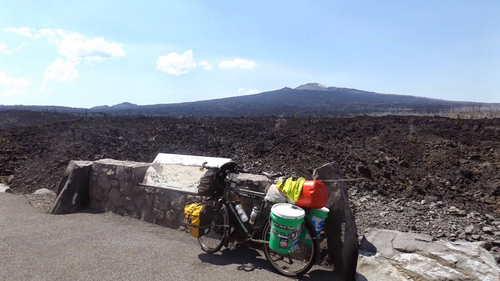
First nice view of Glacier National Park.  Notice Chief Mountain 


 Going-To-The-Sun-Road
 Gunsight Mountain on left

 "Hi MOM"


The "Weeping Wall" at Glacier

 Avalanche Lake
 Mountain Goats Chill
 Muley in camp
 Swan Lake Sunset, smoky skies.
 Part of U of M student Garden with John
 Headed Downtown
 Mizzou Farmers' Market

       Surf Mizzou


Little Ben on his Mad Max tall bike...drinking a soda.


Thursday, July 10, 2014

MT


We've been trucking across Montana--sometimes literally, so we're making good time.  

So we're leaving Glendive, Mt after waiting out the 90+ degree heat.  We left around 5 p.m. headed for a town called Circle, which is about 50 miles West.  Right out of Glendive we ran into another trio of bikers, a newlywed couple and an 18 year old guy. They were heading to the east coast via Washington and were happy to be done with Montana.  Anyways the ride was going well.  Cooler than earlier with gradual hills.  In some places the ground to the side of the road gave way to vast "breaks", as the locals call them, and you sort of get that 'whoa' feeling when looking off the edge of the road down a few hundred feet.  

Right around ten o'clock p.m. I felt my (Jer) chain break.  It had actually separated--one of the links slipped off the pin that connects the series of links to make the chain --most likely because Brady and I were racing up hill not long before.  Anyways, I start trying to fix it immediately in the quickly dissappearing light.  We figured we'd be camping in the ditch that night--we certainly didn't expect to get picked up in the middle of nowhere Montana.  

I hadn't been fixing the chain long and a truck pulls up and asks if we're ok.  We told them we're fine we just had a chain break and we're fixing it up.  The couple offered to take us to Circle which was about 8 miles away.  After a brief meeting we decided it was a good decision as the mosquitoes were closing in and it was getting darker.    

Once we got into their truck we learned their names, Pete and Teresa, they run an 8000 acre  ranch just north of Circle.  After chit chatting a bit they probably figured we weren't weirdos because they offered to put us up for the night.  Whenever you hear, showers and beds it's awesome, especially in mosquito country.  Yet the night kept getting better.  

When we got to their ranch, we unloaded all of our stuff into one of their sheds so we could work on the chain away from the mosquitoes.  We were dinking around with it for awhile before Pete gave us a hand.  He probably has not been on a bike in years and was able to fix it in about five minutes.  They invited us in.  They lived in a big ranch style house with native american throw rugs and stuffed game on the walls.  It felt great.  They gave us the basement guest bedroom.  After he showed us around Pete opened up a fridge full of beer next to a kegerator with a keg from Beaver brook on tap.  "Drink up", he told us more than once.  Soon Teresa came down and asked us if we liked steaks.  "Like the food?"  We asked.  We could not believe it.  She put 'em on the grill and made us the best supper we've had all trip--steaks, salad, squash, potatoes and beer.  All at 10:30 at night--we still can't believe that happened.  We couldn't stop smiling and shaking our heads.  That night we slept like rocks and were up for biscuits and gravy around 7.  

Another weird thing, Teresa's maiden name is Wolff with two f's so she spent some time researching ancestry.com to see if her and Brady were related somehow.  Have not figured it out, yet but it was neat to fantasize about.

It was raining pretty good that morning and we were headed for Wolf Point, Mt which doesn't have the best reputation.  Pete offered us a ride to Fort Peck, about 70 miles down our route and past Wolf Point.  We were happy to have it.  Before we left Pete and Teresa showed us their horses.  Teresa barrel races in rodeos and her aunt happens to be number 1 in the world in barrel racing.  Pete ropes cattle at rodeos, too, so they had a slew of awesome horses.  They showed us the newest edition to their troop a foal born on the 4th of july--they named him Firecracker.  He was beautiful, skittish and all legs.

When we got to Fort Peck Pete gave us a tour of the town and camping spots.  Fort Peck dam is the third largest earthen dam in the world.  It took thousands of guys about 5 years to build and a half dozen of them are still burried in it.  We have to thank Pete and Teresa for all they did for us, another great memory for the trip.  That night we camped on Fort Peck Resevoir which is the panorama at the top of the page.  The biggest lake in Montana.  The water is sky blue and ice cold.

The last few days we have been traversing the Montana range.  A lot of the parts are arid, desolate, and boring.  Not a tree on the horizon, just fields and sky forever.  Plus the land is swarming with mosquitoes and rattlesnakes.  The mosquitoes here of the militant variety.  Sometimes they swarm us even when we're going 15 mph on our bikes.  It makes sense considering the 'unofficial' Montana state bird is the mosquitoe.  

We had our first century day yesterday!  105 miles from Havre to Shelby.  Felt great.  Right now we're in Cut Bank with the Rockies just visible in the distance.  Should be in Glacier National Park tomorrow.  We're so jacked, Rocky Mountain fever!  More stuff to come...       


Just a little better than sleeping the ditch.


7/4/1988 v. 7/4/2014
 

 Group shot
 

 Fort Peck Dam

 
The poem:
 

Nowhere, Mt